Description
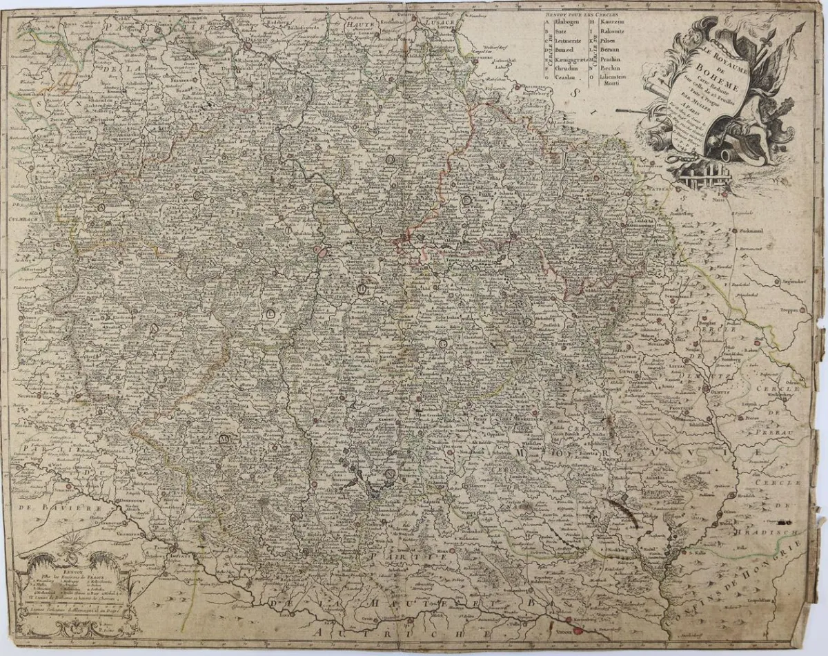
Collection of 5 engraved maps from the 17th and 18th centuries of Luxembourg, Bohemia, Hungary and Hesse. Partly colored by region and borders. Among others by Homann, Dankerts, Jaillot. Partly cut on/along the fold lines, mounted on linen and spot-mounted on cardboard. From 49.4 x 59.5 cm to 53 x 62.2 cm. As well as: Alphabetical index, showing all the places and words. Double sheet from Atlas Novus, Vienna 1730. - Partly with slight edge damage.
Sammlung von 5 Kupferstichkarten des 17. u. 18. Jh. von Luxembourg, Böhmen, Ungarn u. Hessen. Tls. gebiets- u. grenzkolor. U.a. bei Homann, Dankerts, Jaillot. Tls. auf/entlang der Faltlinien zerschnitten, auf Lw. aufgezogen u. punkt. auf Karton mont. Von 49,4 x 59,5 cm bis 53 x 62,2 cm. Sowie: Alphabetischer Index, worin angezeigt wird, wie all die jenige Oerter und Wörter. . Doppelblatt aus Atlas Novus, Wien 1730. - Tls. mit leichten Randläsuren, Mittelfalz u. tls. gebräunt.
Machine translation. The seller's German text is authoritative.
Sale conditions
About the sale
Collection – of 5 engraved maps from the 17th
Original titleSammlung – von 5 Kupferstichkarten des 17
Offered by

Similar lots
 No bids
  No bids
  No bids
  1 bid
1 bid