Beschrijving
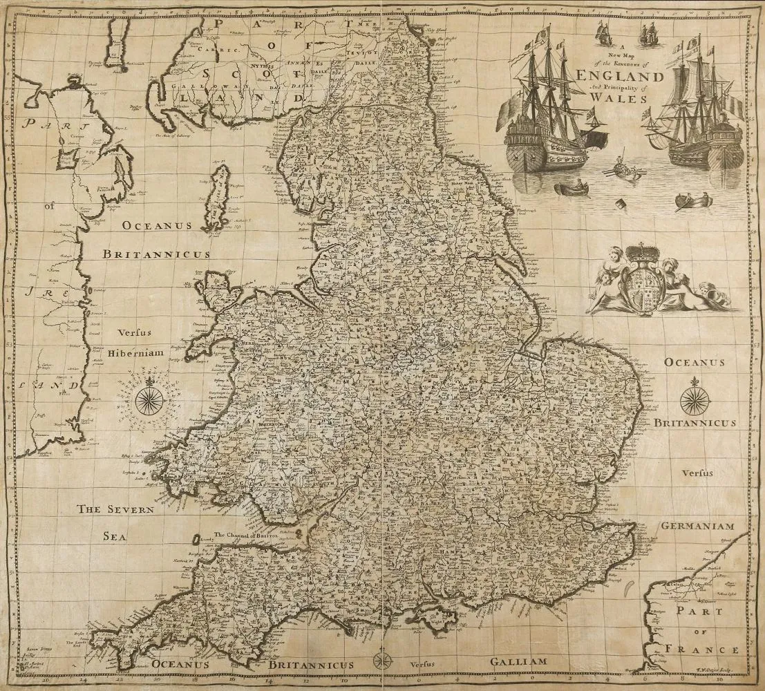
Groot-Brittannië. A new map of the Kingdom of England and the Principality of Wales. Kopergravure kaart gedrukt op linnen en op papier geplakt. Naar F.W. Oetjes bij Robert Mordon, ca. 1690. Plaatgrootte 40 x 54 cm. Apart verschenen kaart bij Mordon, zeldzaam. - Deels sterk gebruind en watervlekken tot in de voorstelling. Vouwscheur tot in de voorstelling. - Ex-collectie Gert Nagel, Stuttgart.
Großbritannien. A new map of the Kingdom of England and the Principality of Wales. Kupferstichkarte auf Lw. gedurckt u. auf Papoer geklebt. Nach F.W. Oetjes bei Robert Mordon, ca. 1690. Plgr. 40 x 54 cm. Se perat erschienene Karte bei Mordon, selten. - Tls. stärker gebräunt u. bis in die Darstellung wasserrandig. Falzriß bis in die Darstellung. - Ex-Sammlung Gert Nagel, Stuttgart.
Automatische vertaling. De Duitse tekst van de verkoper is bindend.
Verkoopvoorwaarden
Over de veiling
Groot-Brittannië. – A new map of the Kingdom of England and the Principality of Wales
Originele titelGroßbritannien. – A new map of the Kingdom of England and the Principality of Wales
Aangeboden door

Vergelijkbare kavels
 Zonder bod
  11 biedingen
  Zonder bod